Now Serving Idaho
Kellar Engineering is now serving Idaho
Kellar Engineering is now serving Idaho
Kellar Engineering is now serving Wyoming
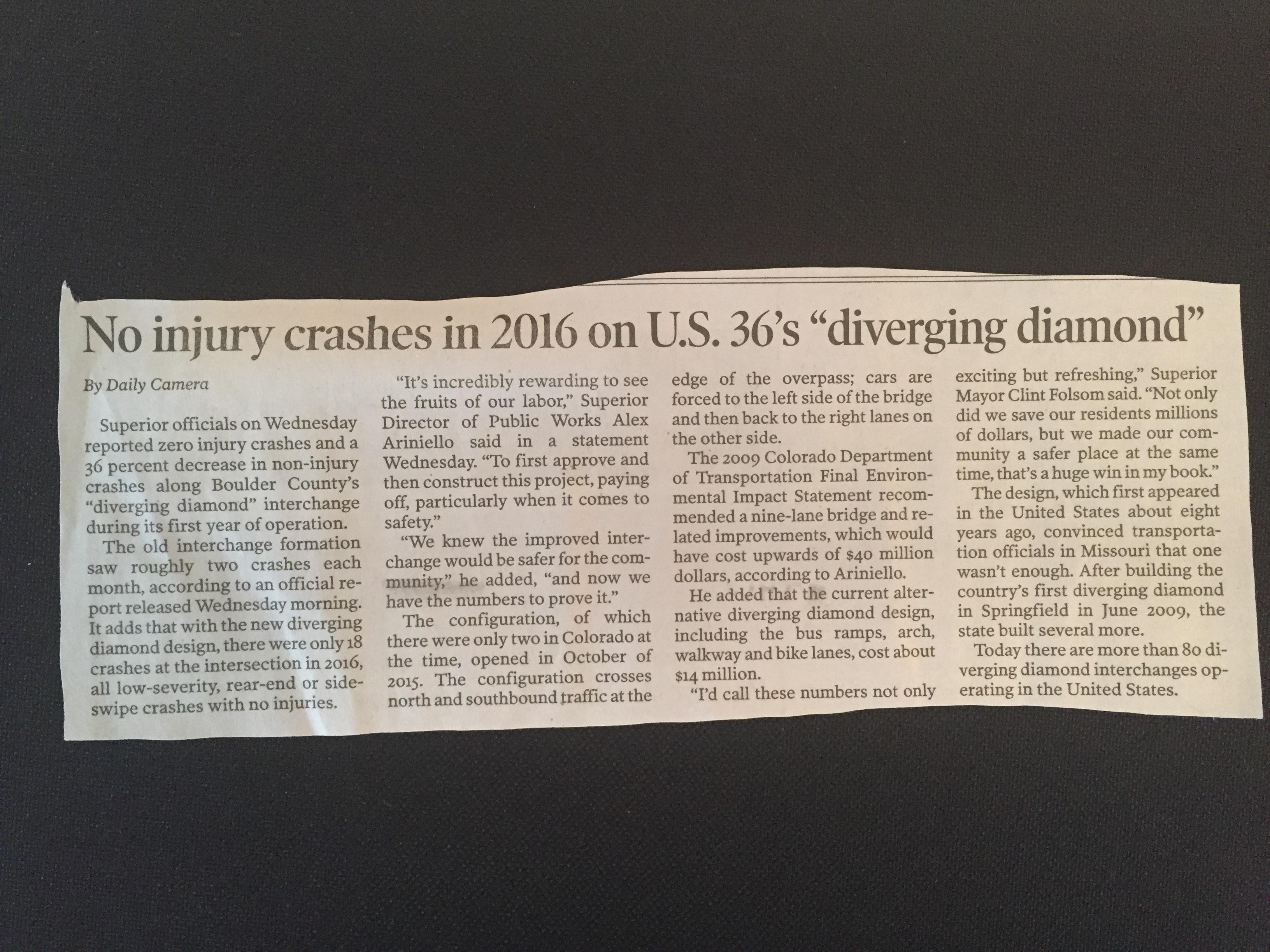
No injury crashes in 2016 on US 36's diverging diamond [...]
Ever go 100 mph in the wrong direction? This [...]
I have spent years working on access management on behalf [...]
Are you using your traffic signal equipment to it's fullest [...]
Traffic Impact Study in Northern Colorado: Current project in Colorado. [...]
I've been asked this question before. "Which is better? [...]